
Waypoint Packages with Ease
With Overflight, you’re no longer limited to entering one point at a time, our system allows you to install massive groups of waypoints simultaneously by simply following the format shown in the example to the right. Whether you’re uploading hundreds of custom flight references or an entire route library, the process is seamless and efficient. This feature pairs perfectly with tools like ChatGPT and other AI resources, giving you the ability to generate large waypoint sets in seconds and import them directly into your EFB. It’s a smarter, faster way to bring your planning from concept to cockpit without wasting valuable time on repetitive data entry.


Dynamic Selection & Editing
Overflight gives you complete control of your workspace with powerful dynamic selection and editing tools. Use the lasso tool or adjustable selection planes to grab, group, file, drag, rotate, and refine any content directly on your screen with ease. Our system is built for flexibility, allowing you to manipulate large sets of data just as effortlessly as single elements. On top of that, customizable styling options let you tailor geometry tools to match your workflow—adjust colors, line weights, and shapes until your overlays look and feel exactly the way you want them.

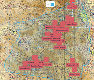
Polygons!
With Overflight, you’ll have the ability to create, customize, and dynamically edit polygons like never before. Whether you’re highlighting complex airspace boundaries, marking out water landing sites, or defining custom operational zones, our tools make it fast, intuitive, and precise. Every polygon can be shaped, styled, and adjusted on the fly, giving you unmatched flexibility to build overlays that perfectly fit your mission needs.

Draw .KML paths like pictures
When it comes to drawing paths, Overflight gives you the freedom to choose your method. You can build precise point-to-point routes, or you can actually draw .kml paths with your mouse cursor—just like sketching a picture directly on the map. This opens the door to powerful new applications, from tracing winding rivers and streams to outlining trails, shorelines, or custom routes with natural accuracy. It’s a flexible, intuitive way to turn your vision into usable flight data in seconds.
What would you like to see?
This is your chance to help shape the future of flight planning. The Overflight Desktop Application is built for pilots, by pilots—and your input matters. Tell us what features, tools, or functions you’d like to see in your ideal overlay creator. Whether it’s smarter route tools, new visualization options, or workflow shortcuts, we want to know. Share your ideas below and help us build the most powerful planning platform in aviation.