


Welcome to Overflight
Navigate with Confidence


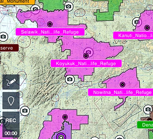
Overflight is your premier marketplace for aviation chart overlays, designed to enhance situational awareness and flight safety. Our precisely crafted navigation data integrates seamlessly with Electronic Flight Bags (EFBs), offering full compatibility with both ForeFlight® and Garmin Pilot™ platforms. Pilots gain instant access to critical VFR waypoints, routes, airspace boundaries, and operational procedures—directly on the tools they already use.
Start with Alaska’s most detailed overlay packages, expand your navigation toolkit with growing regional coverage, and take advantage of our custom solutions tailored to your specific mission requirements. In addition to EFB integration, Overflight also provides solutions for installing both premade and custom overlay content on cockpit-mounted GPS units via wired file upload—ensuring mission-critical data is available no matter your setup.
Fly smarter. Fly safer. Explore Overflight today.

Overflight Desktop - Coming Soon!


The Future of Flight Planning Begins This October
Coming mid-October, Overflight will launch its first Desktop Application, giving pilots an entirely new workspace to create custom overlays with ease. This marks the beginning of our vision to redefine the EFB, with iOS and Android apps to follow in the months ahead. Our mission is to help pilots everywhere plan proactively and execute with unmatched accuracy—erasing the gap between “planning” and “programming” in the cockpit. Overflight is built to evolve with you, and we look forward to user input as we add the most requested features to create the most advanced flight planning platform aviation has ever seen. Click the "Add your Ideas" button to add user features to this up and coming platform!
Disclaimer
Designed to maximize, not to compensate.
Overflight LLC develops third-party navigation overlays out of a genuine concern for the safety and situational awareness of pilots operating in Alaska and beyond. Our products are designed to enhance access to critical information in a clear, intuitive format—especially in areas where timely, applicable data may be lacking or difficult to interpret in-flight. However, these tools are not a substitute for proper flight planning, sound aeronautical decision-making, or pilot proficiency. By using Overflight products, you acknowledge that the safety and legality of any given flight rests solely with the Pilot in Command (PIC). Overflight assumes no responsibility or liability for any incidents, accidents, navigation errors, or other outcomes arising from the use or misuse of its products. While our overlays may support route planning and improve situational awareness, they are intended solely as a third-party reference aid and are not a replacement for FAA-published charts, procedures, or regulatory compliance. Our mission is to build a safer, more informed general aviation community by expanding access to high-quality, context-specific navigation data. We believe thoughtful planning and shared knowledge are the foundation of safe flight—and we’re proud to support pilots with tools that help make that possible.

Digital Overlays for Safer, Smarter Navigation
Overflight transforms FAA Alaska Chart Supplement data into fully interactive digital overlays, providing pilots with waypoints, routes, airspace boundaries, CTAF areas, and other critical navigation details directly on their Electronic Flight Bag (EFB). These overlays eliminate the need for static charts, offering a real-time, high-visibility solution for flying in complex airspace. Beyond chart supplement conversions, Overflight enhances situational awareness by incorporating locally known visual waypoints and historical descriptions, making it an essential tool for sightseeing, tour flights, and general aviation. Our goal is to provide every pilot—regardless of experience level—access to the local knowledge that seasoned aviators rely on, improving safety, confidence, and operational efficiency.
While our initial focus is Alaska, Overflight is expanding to bring this equitable navigation advantage to pilots across the Lower 48. Additionally, we offer custom overlays tailored to specific flying needs, including specialized routes, private airstrips, and mission-specific navigation. Wherever you fly, Overflight ensures you navigate with confidence and clarity.


Specialized Content


Commercial Content
Overflight Commercial Content is built for flight schools, operators, and all aviation industry members that demand reliable, mission-ready navigation data across all major platforms. Subscribers receive full access to our complete library of ForeFlight® Content Packs, Garmin Pilot™ .kmz files, and .gpx overlays for cockpit-mounted GPS units—plus one custom content request per month tailored to your routes, missions, or training needs. With prioritized support, flexible licensing, and regularly updated content, Overflight Commercial gives your entire team the tools to fly smarter, safer, and more efficiently.
Utilizing our Products
Our content packages are available in .KML, .GPX, and .ZIP file formats, ensuring compatibility across a range of Electronic Flight Bags (EFBs) or GPS devices. Pilots using any version of ForeFlight—including Basic and Performance plans—can take advantage of content pack support via .ZIP downloads, which include all overlays along with PDF waypoint imagery. Garmin Pilot users can seamlessly integrate overlays using .KML and .KMZ files. For users with commercial or ultimate subscriptions, we also offer waypoint-only packages in .GPX format, ideal for uploading to standalone GPS units or flight planning software that supports .GPX data. To get started, visit our Installation page for a guided tour on how to install and use Overflight content with your preferred EFB or GPS platform.


Enhancing Situational Awareness


Stay Tuned
Overflight is set to revolutionize situational awareness for pilots across the country by bridging the gap between static chart data and real-time digital navigation. By converting FAA chart supplement information into interactive, high-visibility overlays, pilots can now seamlessly integrate waypoints, airspace boundaries, CTAF areas, and routes directly onto their Electronic Flight Bags (EFBs). But Overflight goes beyond official data—our overlays also include locally known visual waypoints and historical references, providing invaluable insight that previously required years of experience to acquire. This leveling of the playing field means that pilots flying in unfamiliar regions can access the same intuitive navigation data that local experts rely on, making every flight safer, more efficient, and more accessible. As Overflight expands nationwide, this technology will fundamentally change how pilots interpret their airspace, enhancing confidence and reducing the risks of navigating unknown environments.